


India Makes History with GSLV-F16 Launch of NISAR Satellite: A Leap in Global Earth Monitoring
Sriharikota, July 30, 2025 — In a monumental achievement for international space cooperation, India successfully launched the GSLV-F16 carrying the groundbreaking NISAR satellite, jointly developed by the Indian Space Research Organisation (ISRO) and the National Aeronautics and Space Administration (NASA). The satellite was deployed precisely into a 743 km sun-synchronous orbit, marking a new era of Earth observation and climate science.
What is NISAR? The Most Advanced Radar Eye in the Sky
NISAR—short for NASA-ISRO Synthetic Aperture Radar—is the world’s first dual-frequency radar imaging satellite, equipped to capture ultra-detailed snapshots of Earth’s surface every 12 days, regardless of cloud cover or darkness. This dual capability, combining L-band (NASA) and S-band (ISRO) radar technologies, allows for the detection of subtle surface changes such as glacial movements, tectonic shifts, landslides, and vegetation dynamics with exceptional precision.
Built to weigh nearly 2.4 tonnes, NISAR is designed around ISRO’s robust I3K satellite bus and features NASA’s 12-meter foldable mesh antenna, making it one of the most powerful and sensitive Earth-observing satellites ever launched.
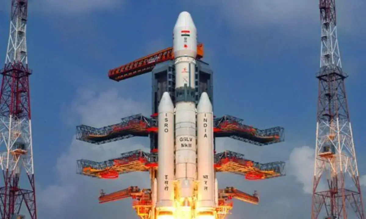
GSLV-F16: India’s Cryogenic Power at Work
The Geosynchronous Satellite Launch Vehicle F16 (GSLV-F16) marks the 18th flight of the GSLV family and the 12th mission using the Mk II variant, which is powered by India’s indigenous cryogenic engine. This three-stage heavy-lift launch vehicle stands over 51 meters tall and lifted off with a mass of 420 tonnes, delivering its high-value payload into orbit with remarkable accuracy.
The mission’s success further cements ISRO’s reliability in cryogenic propulsion technology, a domain once dominated by only a handful of space-faring nations.
Why NISAR Matters: Science, Safety, and Sustainability
The NISAR satellite isn’t just a marvel of engineering—it’s a game-changer for Earth sciences. Its radar sensors are capable of monitoring:
- Earthquakes and fault lines
- Glacier and polar ice melt
- Shoreline and coastal erosion
- Forest biomass and deforestation
- Flood mapping and storm damage
- Soil moisture and agricultural stress
With a mission lifespan of five years, NISAR will provide continuous, high-resolution data critical for early disaster warning systems, climate research, agricultural planning, and ecosystem conservation—making it invaluable not only to India and the US, but to global researchers and policymakers.
A Decade of Collaboration, A Launch of Significance
The NISAR mission is the result of over 10 years of bilateral collaboration, with engineering teams from both nations working across continents to overcome technical hurdles. One notable challenge involved precision adjustments to the satellite’s radar reflector, requiring NASA to rework key components before final integration in India.
This collaborative triumph exemplifies the strength of global cooperation in tackling complex planetary challenges through science and innovation.
Mission Operations & Data Sharing
Post-launch, ISRO is in charge of satellite commanding, operations, and the functioning of the S-band radar system. NASA contributes the L-band radar and handles high-speed data reception, onboard storage, and GPS-based orbit tracking. The mission employs a joint ground station network to manage and distribute its data.
True to the spirit of open science, all collected data will be made freely available, empowering global scientific communities to harness insights for climate resilience, disaster management, and environmental sustainability.
Engineered for the Future
From its cutting-edge SweepSAR technology to its modular spacecraft design, NISAR is engineered for longevity, adaptability, and precision. The orbit—carefully selected for sun-synchronous operations—ensures consistent lighting conditions and global coverage every 12 days, giving researchers a dependable dataset for long-term analysis.
This regular revisit capability is crucial for spotting changes in dynamic environments such as forests, rivers, and mountain ranges—essential for both scientific study and real-time decision-making.
Global Impact, Local Pride
Beyond scientific goals, the successful GSLV-F16 launch is a bold statement of India’s growing prominence in global space leadership. By seamlessly delivering such a high-value satellite into orbit, ISRO demonstrates not only technical mastery but its capacity to lead in missions of international significance.
The mission also showcases how space science can become a shared bridge between nations, driving progress for humanity while also serving national aspirations.
Conclusion: Eyes in the Sky, Vision for the Earth
As NISAR begins its operational journey in orbit, it symbolizes more than just technological excellence—it represents a vision of collaborative stewardship of our planet. This mission blends India’s engineering ingenuity with America’s scientific depth, setting a high standard for future space collaborations.
With each orbit, NISAR will provide us not only with data—but with insight, foresight, and the means to build a more informed, resilient, and sustainable world.
If you have insights, questions, or sports stories you’d like to share, get in touch with us here